Ulaan Baatar
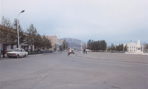
Of a total population of 2.3 million, 7,000,000 live in UB. The city sprawls over a plain enclosed by conifer-wooded hills, by the side of a river (the Tuul). The centre looks quite western: most of the buildings are Russian-style tenement blocks with large empty squares, there are numerous cafes selling western food, most of which advertise 'internet', the cars are shiny new Toyotas or BMWs, and the people all wear western clothes. We saw virtually no beggars and few pavement vendors. There's one four-storey department store selling a wide range of goods both to tourists and locals, also a very large market area. The western buildings are surrounded by extensive ger encampments. Public transport is extremely cheap: we travelled by bus across half the city for a few pence. One got the sense of an uneasy transition away from Communism: there's certainly some wealth, but possibly less equality.
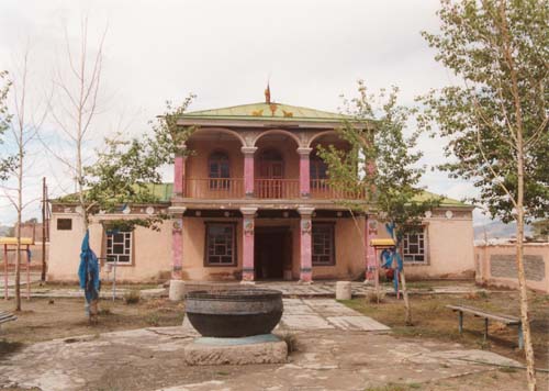
The main Buddhist temple was left by the Russians as a tourist site. There's also a national museum, with a large collection of the various Mongolian tribes' national dress.
The weather was very hot and dry, though apparently in winter the temperature drops to -40^C. Heating is via piped water from power stations miles out of the city, carried in monstrous lagged pipes. The main industry appears to be coal mining.
Terelj National Park
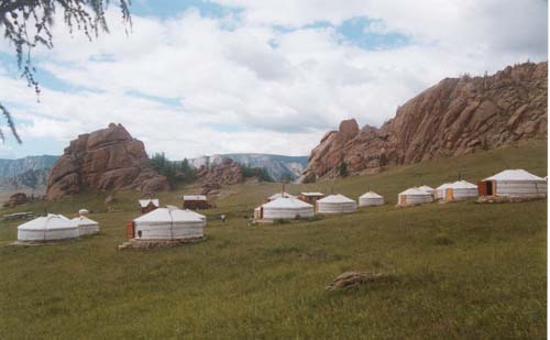
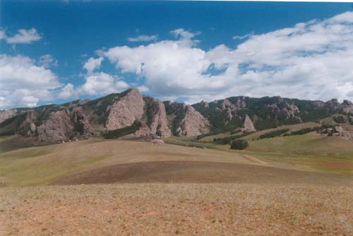
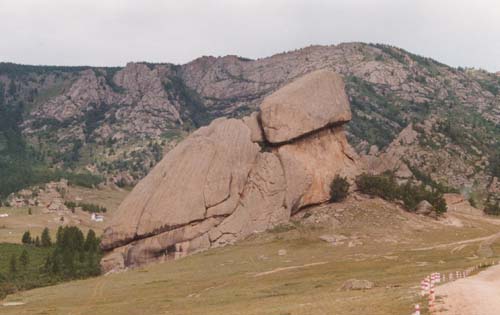
The Terelj is a rocky area a couple of hours from Ulaan Baatar. The ger encampment we visited in the Terelj is set up for tourist accommodation, though many of the tourists are from UB. The undulating plain is sparsely wooded with conifers and birches, and sports numerous heavily-eroded rock formations. Turtle Rock is one of the largest. The granite was exceptionally soft and friable.
Hovd and surroundings
We spent several unplanned days in the western town of Hovd when rain and low cloud at Bayaan Olgii prevented planes from landing. This market town, the centre for a large area of Western Mongolia, boasted two streets, a deserted town square, a small temple, an agricultural university, two kiosks, a market, and a large ger encampment. Quarrying was the main industry, but after the Russian withdrawal, this largely ceased.
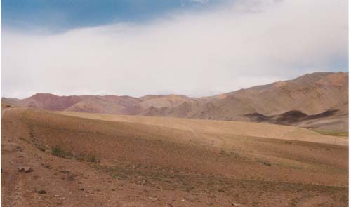
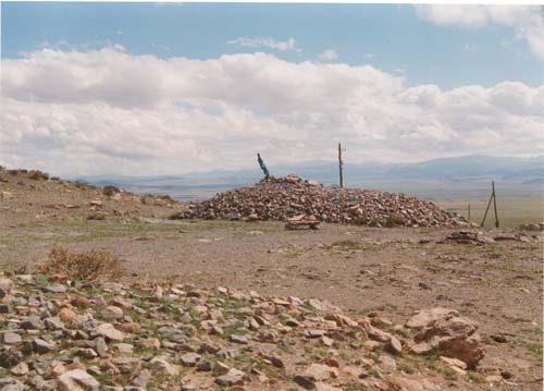
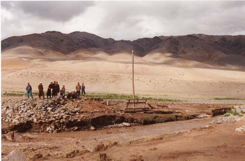
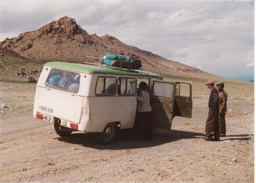
The town lies on an arid plain surrounded by low hills. We stopped at a roadside stupa, with views across the plain to distant hills, and walked round it three times for luck on the journey. Rain also brought down this bridge on the way to Bayan Olgii by jeep and battered minibus.
Altai region (Altai-Tavan Bogd National Park)
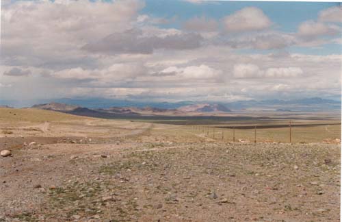
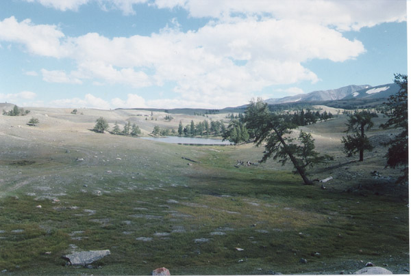
This mountainous region (map -- note 228kb file) lies in the extreme west of Mongolia, near the Chinese and Russian borders. The capital is Bayan Olgii. The inhabitants are Kazakhs, speaking Kazakh and of Muslim religion. They are mostly nomadic, living in the summer in traditional gers and overwintering in Altai village or Bayaan Olgii. The vegetation here is more lush than elsewhere, with many lakes.
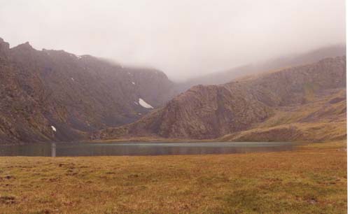
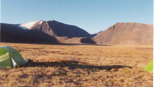
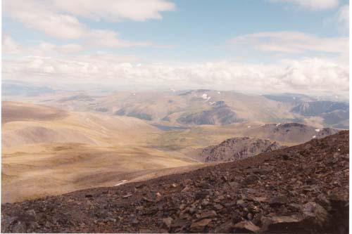
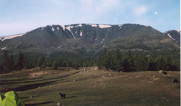
We started our trek at a mountain lake about six hours from Olgii by jeep; here's the campsite and view up towards the pass. We passed this remote mountain tarn on our first day's trek. The terrain here was boggy and tree-less, with numerous alpine-like flowers. Later the group climbed the 3571m Halagash uul. Here's the view back from the summit. That night, we camped beside another idyllic lake.
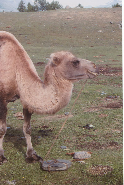
We drank fermented yak's milk with this Kazakh family, in the next valley over. We spent the evening in a ger on a vast dry plain adjacent to the huge Lake Dayan. All the gers we saw had the same layout: a central stove fueled with cakes of dried dung is used for cooking and heating (there's no electricity), the floor and walls of the ger are covered in hand-embroidered rugs, the beds are ranged round the outer wall, as are the cupboards, which are hand-painted in bright colours. The only sign of modern technology is the battery-powered radio. We watched the grandmother of the family prepare noodle soup for our supper by candlelight; her first step was to roll out the dough to make the noodles. The diet consists of meat (unrefrigerated) and milk supplemented with bread and noodles (the flour is imported); they do not appear to grow or eat any vegetables. Despite the proximity to the lake, this family did not eat fish (they gave the fish we'd caught to the dog). Transport for these ger-dwellers is by horse or camel, although many encampments have a truck, used for moving the ger every year.
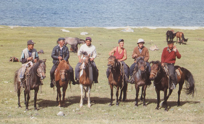
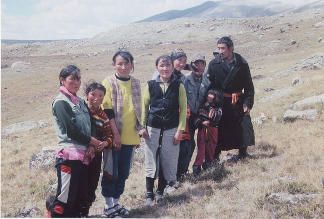
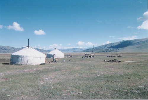
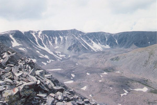
Our final campsite was at a picturesque ger encampment (large file) set in rolling grassland and conifer woods by the huge Lake Hoton. Adrian and I climbed an unnamed 3507m peak adjacent to the Chinese border, with spectacular views across Lake Hoton, over the adjacent peaks of the range, and into China. We also went pony-trekking by the lake, riding Mongolian style. Our Mongolian guides (see picture at top of this page) performed traditional horse games at the lakeside, then challenged the men in the party to wrestling matches, Mongolian style. That evening we exchanged folk songs around a bonfire with the Mongolian guides and Kazakh locals; it was notable that the Mongolians' and Kazakhs' store of folk music was considerably larger than ours (despite drawing on NZ, US & UK members).
Tavia
21 January 2002
The trip was organised by KE Adventure Travel who are currently running a number of treks in Mongolia, but not this particular one.
You can e-mail me at: the_espresso_addict@fireflyuk.net
Last updated 22 March 2003